
LIDAR is a unique remote sensing technology that has taken the surveying industry by storm. The acronym “LIDAR” stands for Light Detection and Ranging and describes how the technology uses light in the form of lasers to measure distances. LiDAR measures distances by emitting laser pulses and calculating how long it takes for the light to return. This remote sensing technology creates detailed 3D models and is widely used in surveying and other industries. Take-Off Professionals’ data specialists can compile the data collected by a LIDAR system and use it to create exceptionally precise three-dimensional information about a specific area and its characteristics. LIDAR is an ideal system for a variety of industries, including the civil engineering, roadwork and mining industries.
JUMP TO SECTION
The Mechanics of LIDAR Surveying: A Deep Dive
A LIDAR instrument consists of a laser, a scanner and a GPS survey receiver mounted on a platform. This platform may be mobile or stationary, aerial or terrestrial, based on the needs of the application — the laser, scanner and GPS receiver are the only constants.
There are two types of LIDAR — topographic and bathymetric. These are explained in more detail below:
- Topographic: Topographic LIDAR measures distances on land using a near-infrared laser. This is essential for the majority of civil engineering, roadwork and mining operations, which require measuring distances on land.
- Bathymetric: Bathymetric LIDAR measures distances in aquatic environments by using a water-penetrating green light laser. This type of LIDAR is commonly used in civil engineering and roadwork applications that require working with underwater environments, such as under bridges.
But how does LIDAR surveying work on a technical level? LIDAR works by pointing a laser at a target surface on the ground or under the water. The surface reflects the light back to the LIDAR equipment, and the sensor records the reflected light to measure the distance traveled. This data is then combined with the position and orientation of the LIDAR equipment, which is measured using the GPS receiver and internal measurement systems. This creates a set of three-dimensional spatial coordinates that include latitude, longitude and height, creating a combination of data that is called a point.
When land surveying with LIDAR, the LIDAR equipment collects innumerable points using the measurement methods described above. This collection of points is called a “point cloud.” This “point cloud” is what a LIDAR survey is conducted for — it is the crucial data that companies use to create 3D models of the terrain that they are working with.
Transform Your Project with Expert Lidar Solutions
Benefit from the fast-paced Lidar technology with our precision 3D models and quantify takeoff services across various industry domains. Our adept methods combined with innovative technology can revolutionize your 3D machine control modeling needs.
The Compelling Benefits of Utilizing LIDAR Technology
LIDAR is a highly advantageous survey system for a range of industries, primarily due to the following factors:
- Speed: LIDAR can collect a million points of data per second, making it an exceptionally fast method of surveying. Scans of building interiors can last an average of three minutes, but even large-scale surveys can take under an hour to complete, making LIDAR one of the fastest surveying methods available.
- Accuracy: LIDAR systems collect extremely dense data with very little room between points. This means that the results are highly accurate, allowing professionals to plot and model natural and man-made geographies with the level of precision they need to plan detailed projects.
- Flexibility: When it comes to surveying land with LIDAR, there are plenty of options to choose from. LIDAR systems can be mounted on a variety of platforms based on the needs of an application. For small-scale surveying, a stationary tripod may suffice. LIDAR systems could also be mounted to airplanes, helicopters or drones to survey larger areas. LIDAR data can even be collected at any time of day or night since it uses light as the measurement tool.
- Safety: LIDAR systems work relatively quickly and can be operated from a distance, making them a good choice for locations that may be unsafe for human operators to stay for extended periods of time. Their ability to be mounted to aerial crafts also allows them to be used to survey dangerous areas that human surveyors may not normally be able to access.
In addition to these advantages, LIDAR can be integrated with other data sources with relative ease. The key to effectively using LIDAR data, however, is working with a quality data processing company like Take-Off Professionals who can effectively use that data to deliver high-quality 3D models.
Related Article: The Ultimate Guide to 3D Modeling in Construction
Professions and Fields Where LIDAR Surveying Shines
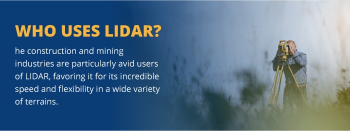
LIDAR is used in a wide range of industries, primarily those involving land management and planning efforts. The construction and mining industries are particularly avid users of LIDAR, favoring it for its incredible speed and flexibility in a wide variety of terrains. Below are some of the largest industries using LIDAR technology in their operations:
LIDAR in Civil Engineering and Land Surveying: A Precision Game-Changer
The use of LIDAR in civil engineering and surveying is extensive. LIDAR applications in civil engineering and surveying include, but are not limited to, the following:
- Design: Civil engineering companies prefer LIDAR technology for its ability to offer extremely accurate results within a short time, which is essential for planning projects around terrestrial limitations.
- Evaluation: Civil engineers often use LIDAR to inspect existing buildings and construction products for defects and changes. Comparing the data to previous data can identify changes in structure that would otherwise be difficult to find.
- Surveying: Surveyors prefer LIDAR to help them create detailed 3D images, including the landscape and any vegetation or existing structures.
The key reasons that LIDAR is favored among civil engineering and surveying companies are as follows:
- Speed: Civil engineers and surveyors have a limited amount of time to get their measurements and are often working on a tight schedule due to budgetary restrictions and client needs. LIDAR allows surveys to be completed within a very short time and can work throughout the day and night, delivering results as quickly as possible.
- Accuracy: Civil engineers and surveyors need detailed topographic layouts to plan projects effectively for client needs. Because of the density of the data delivered by LIDAR, engineers and surveyors can collect the precise data they need to get the job done correctly.
- Safety: Surveys take place on a variety of terrains, some of which can be hazardous or difficult to access. LIDAR systems can be mounted on remote-controlled or aerial platforms to collect data at a safe distance, increasing employee safety.
Once the data is collected, civil engineers and surveyors can process the data by working with Take-Off Professionals’ 3D modeling services for commercial applications, delivering the quality models they and their clients need.
Revolutionizing Road and Highway Development with LIDAR
Using LIDAR in construction for roadwork and highway projects is another extremely important application of the technology. Some of the most common applications of LIDAR in highway and road networks are detailed below:
- Road planning: Terrestrial LIDAR can be used to survey land for new road projects, collecting massive amounts of data that can be used to create detailed 3D models for roadwork projects. This data can be used for planning and machine control modeling.
- Maintenance assessments: The continuous movement of vehicles combined with environmental factors like rain and temperature fluctuations result in significant damage to roadways and railways over time. If left unchecked, road damage can result in automobile accidents and other critical issues. LIDAR can help by scanning massive lengths of a road with incredible accuracy. The data can then be used to create comprehensive road profiles that can help identify structural problems and predict potential developments over time.
- Bridge construction: Bathymetric LIDAR offers extreme accuracy for modeling underwater environments, which can be a key tool for bridge construction efforts. These measurements can be used to plan and construct bridges with a greater level of cost and labor-efficiency.
In addition to these applications, LIDAR has been used in adaptive cruise control systems and is a topic of exploration for self-driving vehicles.
The key reasons that LIDAR is favored in the highway and roadwork industry include:
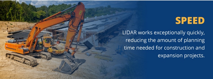
- Speed: Roadwork and railway professionals need to work quickly — every day that a road is closed is one more day that traffic must be diverted or paused. LIDAR works exceptionally quickly, reducing the amount of planning time needed for construction and expansion projects.
- Accuracy: LIDAR systems are highly accurate, which is essential for any construction project, including highway and road construction projects.
- Flexibility: LIDAR can be used during the day or at night, can measure terrestrial and underwater environments and can be stationary or mobile. For roadwork applications, this level of flexibility is essential to meet all the needs of roadwork construction and maintenance.
Once road data is collected, roadwork and railway professionals can send the collected data for processing. Take-Off Professionals can help with our top-of-the-line data processing services for roadwork and highway industry applications. We can take your road data and provide the quality models your organization needs to achieve quick and accurate results.
The Strategic Role of LIDAR in Mining and Quarry Management
LIDAR is used in mines and quarries as an essential surveying tool. By their nature, mines and quarries are often in remote areas with limited access, rough terrain and limited light. As a result, when looking at lidar vs. traditional surveying, the traditional surveying methods are largely impractical. LIDAR offers a comprehensive solution that can be applied for quarries and mines, producing accurate and effective results. Some LIDAR applications in the mining industry include:
- Volume measurements: Quarries require regular volume measurements to determine how much product has been collected and how much still remains. LIDAR can accomplish this quickly and easily through detailed terrain mapping, which can be compared with previous surveys to create comprehensive volume measurements.
- Mine mapping: Mines can be extremely intricate and complex in their construction, and regular mapping is necessary to ensure that current maps are accurate and that mines are constructed safely. LIDAR can accomplish this quickly and accurately, creating 3D maps of entire mining networks as needed.
- Tunnel construction: Tunnel projects must be carefully planned to ensure the safety of workers. LIDAR is often preferred for this purpose for its incredible accuracy as well as its ability to be used in dark environments.
Some of the key reasons that mining and quarry companies choose LIDAR for their surveying needs include:
- Accuracy: Mines are dangerous working environments and quarries require extreme accuracy to measure volumes and plan projects effectively. LIDAR systems collect data with incredible density, providing the accurate results mining and quarry companies need to move forward in their operations
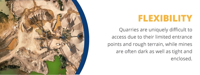
- Flexibility: Quarries are uniquely difficult to access due to their limited entrance points and rough terrain, while mines are often dark as well as tight and enclosed. LIDAR offers solutions to both of these problems. LIDAR can easily be adapted for aerial use, making it easy to survey quarries accurately without using the rough pathways. Additionally, LIDAR can work in the incredibly dark environment of a mine since it uses light as a measurement tool.
- Safety: Mines and quarries are both rough environments to navigate on foot. Quarries are often limited in the number of access points they provide and may include steep dropoffs. Mines, on the other hand, can feature rough walking environments and tight spaces but feature the added challenge of extreme darkness. Both environments are dangerous for humans to navigate, but remotely controlled LIDAR systems can handle them.
Once the appropriate data is collected, mining and quarry companies need their data processed as quickly as possible so they can continue with their operations. Instead of processing it themselves, they can rely on a specialist in the field who is familiar with LIDAR data. Take-Off Professionals can help with that. Our point cloud modeling services can be used for a variety of purposes from layout planning to machine control. We will take your mine or quarry’s point cloud and provide the accurate results your business needs to succeed.
Elevate Your Project’s Potential with Take-Off Professionals’ LIDAR Expertise
If your company uses or is interested in using LIDAR technology, you need a data industry leader to help compile your data and deliver fast and accurate results. Take-Off Professionals can help.
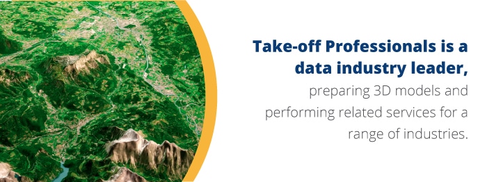
Take-off Professionals is a data industry leader, preparing data and 3D models while also performing quantity takeoff services for a range of industries. We have extensive experience working with LIDAR technology and understand how LIDAR mapping works and how to use it. We are experienced at taking the data collected through LIDAR methods and compiling it into comprehensive, actionable models that companies in the civil engineering, roadwork and mining industries can use. We can help with any type of project from commercial construction to roadwork and mining operations.
Regardless of the system you use, Take-Off Professionals can work with you. We’ve worked with Carlson, Leica, Topcon, Trimble and more and provided our models in a range of final formats to meet the needs of our clients. This makes us an ideal choice for multi-brand fleets.
For over two decades, Take-Off Professionals has provided 3D models for construction companies and related industry professionals, producing about 1,000 machine control models a year. During that time, we’ve maintained a reputation for accuracy, timeliness and attention to detail that speaks for itself. Our knowledge and experience combined with the most advanced and innovative technology in the industry make us the ideal choice for your 3D machine control modeling needs.
Ready to get started with LIDAR surveying? Contact Take-Off Professionals’ team of Data Preparation experts today by filling out our online contact form or calling us at 623-323-8441.