DATA PREPARATION & MODELING SERVICES
Take-Off Professionals prepares a 3D model and performs related services for any project, from commercial sites to subdivisions, roads, and much more.
Unlock Precision Across Your Projects With Seamless 3D Modeling
Experience unparalleled precision with our cutting-edge data preparation and data modeling services, tailored to fit any system—be it Carlson, Leica, Topcon, or Trimble. No matter which design software your engineers use—Civil 3D, MicroStation, or any other—we deliver the final 3D model in the exact format your equipment requires. Seamlessly support your multi-brand fleet with ease.
Leverage our extensive expertise in data modeling services and state-of-the-art modeling technology to ensure your project is executed with laser-sharp focus, guaranteeing exceptional results from start to finish. Trust us to elevate your project’s success and deliver the confidence of a job perfectly accomplished.
Call us at 623-323-8441 to speak directly with a member of our team.
Comprehensive 3D Modeling Services
Transform your construction and earthmoving projects with our specialized 3D modeling services. From GPS machine control models to advanced digital terrain models, we provide tailored solutions to enhance precision and efficiency across various applications. Explore our offerings, including 3D paving, structural excavation, and utilities models, to unlock unparalleled insights and streamline your project execution.
GPS MACHINE CONTROL MODELS
GPS Modeling and Machine Control Modeling Services for All Your Earthmoving Needs
3D Paving Models
Revolutionize Pavement Projects with 3D Paving Modeling for Cost Efficiency and Precision
3D Structural Excavation Models
Enhance Your Excavation Projects with Custom 3D Structural Models
3D Utilities Models
Unlock Subsurface Insights with Innovative 3D Utilities Modeling Services
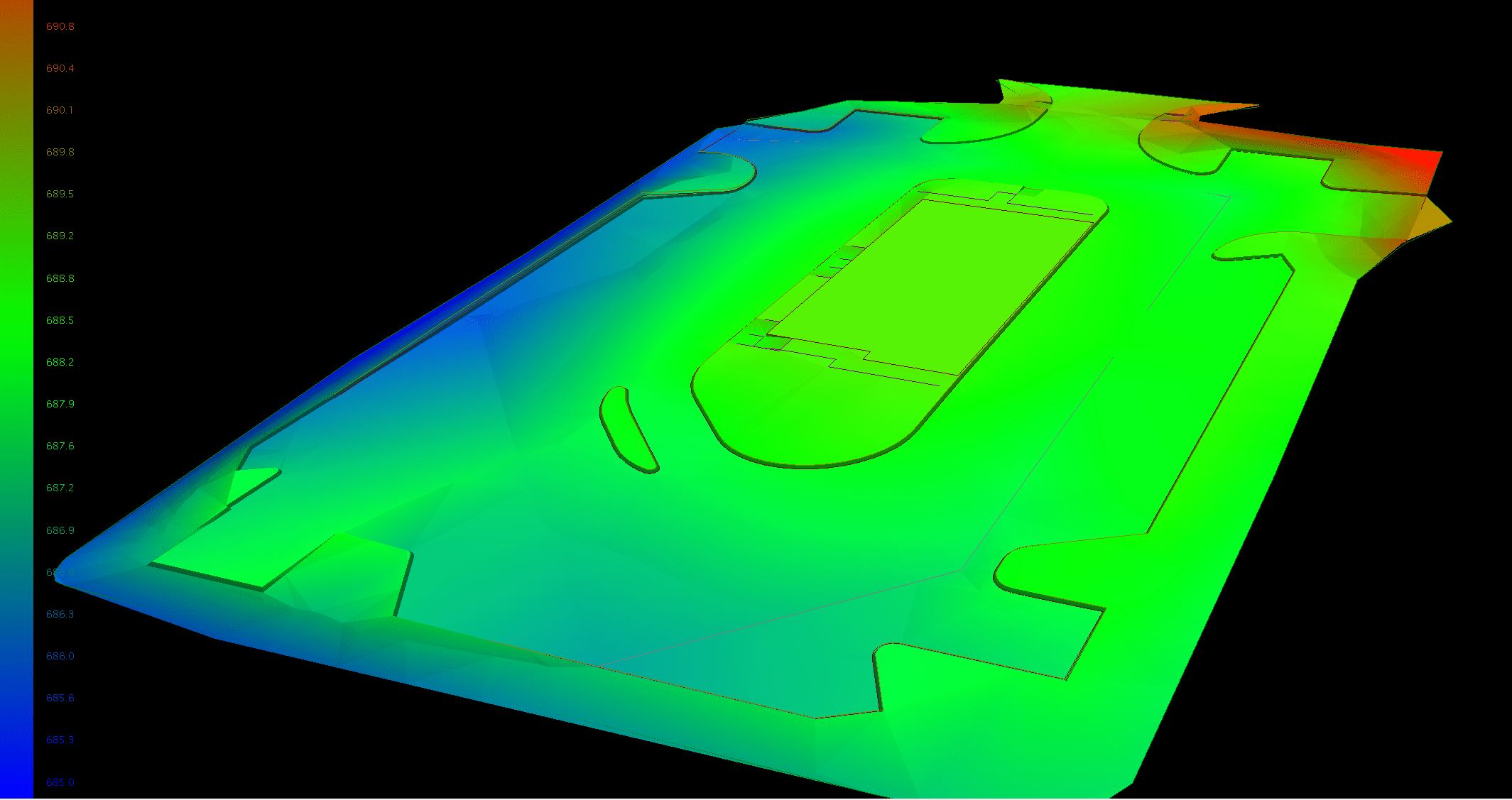
Digital Surface Models
Unlock In-Depth Insights with Advanced Digital Surface Modeling Services

Digital Terrain Models
Streamline Infrastructure Planning with Advanced Digital Terrain Modeling Services
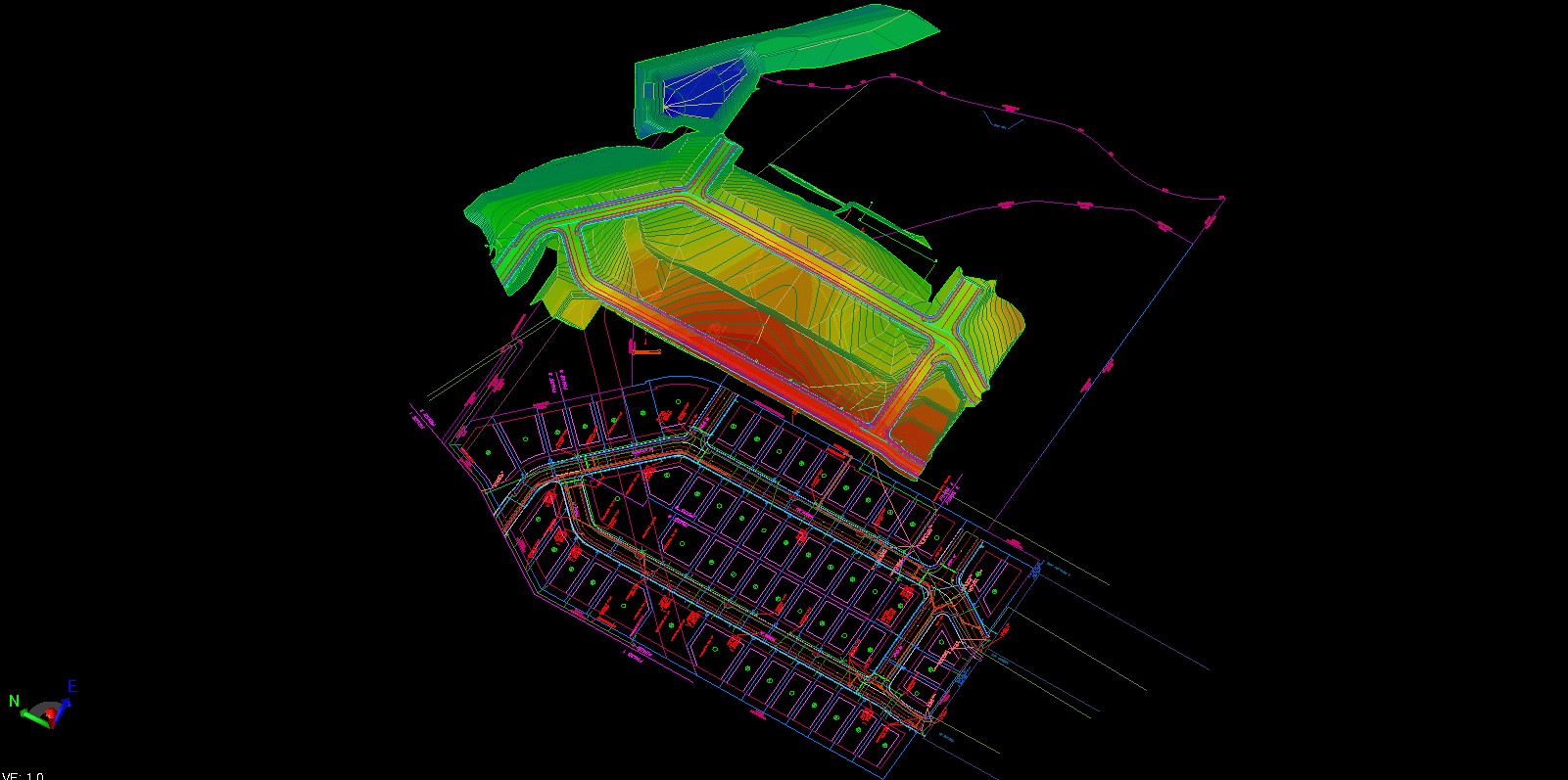
Commercial Site Models for Precision and Performance in Every Detail
Commercial sites are natural for machine control and precision layout. Paving must drain with proper slopes, bird bath puddles are costly to fix. We build the model on the screen as many times as it takes, leveraging our 3D data modeling expertise, in order to give you a surface that will perform and make a quality job.
WHAT WE PROVIDE FOR A TYPICAL SITE MODEL:
- Parking lot surface to finish
- Larger islands and building area curbs built. Small island curbs are graded through in the model just as you do them in the field.
- Building pads and blow ups if requested
- Retention and sheet grading areas
- 2D line work of utilities
- Existing conditions
- Points for layout of items built for the surface including buildings, curbs and tops and toes of retention’s.
These are just examples, ask us and we will do it for you.
OPTIONAL ITEMS INVOLVING EXTRA COST:
- Full 3D utility layout for storm and sanitary. Includes points and offsets for flow-line of pipe, structure corners and rims. This is comprehensive survey layout information for utility placement.
- 3D Utility trench networks for machine control excavators.
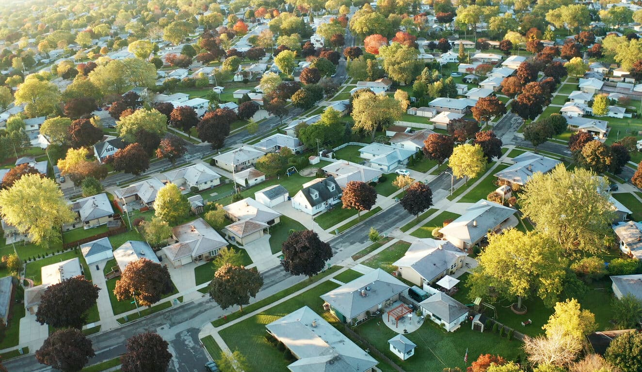
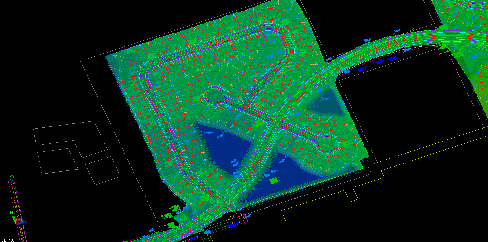
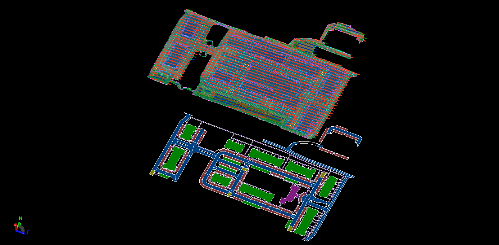
Transform Your Residential Projects With Expertly Crafted Subdivision Modeling Solutions
Moving beyond a typical site, subdivisions have many of the same grading areas of a site with the addition of plan and profile roadways. Through our machine control services, we build the grading and pad information by starting with the Site Model description and add the following;
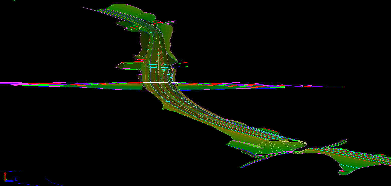
Precision-Engineered Road Models to Deliver Superior New Construction and Rehabilitation Outcomes
Road work has two distinct processes; New Construction and Rehabilitation:
NEW CONSTRUCTION:
- All road work is done by hand. We enter alignments, build templates and make a road conforming to the engineering. Nothing is left to chance, better data means no rework.
- All our work can be used with precision GPS and robotic systems. Accuracy to 3 digits for imperial units and 4 digits for metric work.
- We can build daylight to daylight or driving lanes only per your request.
REHABILITATION:
- Mill and replace needs special attention. We are experienced with creating milling models as well as un-compacted surface files in order to minimize material and increase profits.
- Lane additions require detailed existing condition information so the new lanes do not need grinding and proper pavement depths are maintained.

Three Simple Steps to Begin Your Project
People often ask what we need to get started on data prep for a project. The process is simple. We just need 3 things to get your data prep job started:
Step 1: PDF Plans
The first thing we need is the civil PDF plan set. This is the heart of the project and should contain all the information needed to build a detailed model or takeoff. Plans should show existing conditions, proposed layout, grading, and utilities, as well as demolition, erosion control, and more. Plans typically come in two formats: vector and raster. Vector PDFs are directly exported from the CAD files and have infinite scalability and sharp quality. Raster PDFs usually result from scanned pages and become pixelated or blurry when zoomed in. Vector plans are always preferred, but we can work with either.

Step 2: CAD Files
The next thing we need is the civil CAD drawings. CAD is compared to the PDF plans to ensure all project data matches and is up to date. We can work with almost any common file format, including the industry-standard AutoCAD .DXF and .DWG, as well as numerous proprietary formats like: PRO, TTM, TIN, DGN, GC3, TP3, TN3, and LN3. Some projects can be completed without CAD, but utilizing these files helps ensure the lowest possible cost and highest quality results.
Step 3: Project Details
Let us know how you want your project built. We can customize any job to your specific needs. You can follow the link on our website to fill out a data prep work order, or email us directly. Just provide the details for your scope of work. No matter what you want or need, we can build it!
We try to make the process as smooth as possible. If you need help or have any questions, just call, email, or click the link to contact us. We are here to help.
Ready to discuss your project?
FREQUENTLY ASKED QUESTIONS
How does accurate data preparation improve construction project outcomes?
Accurate data preparation ensures that all project stakeholders are working with reliable and consistent information. This reduces errors, minimizes rework, and improves overall project efficiency. Takeoff Pros specializes in data preparation services that lead to better decision-making and successful project completion.
What is the difference between GPS machine control models and digital terrain models?
GPS machine control models are specifically designed to guide heavy machinery in real-time, providing precise location and elevation data. Digital terrain models (DTMs) represent the bare earth surface and are used for visualization and analysis. Takeoff Pros creates both types of models, tailored to specific project needs.
How are 3D models used to optimize data for highway and roadwork projects?
3D models enable accurate quantity calculations, efficient earthwork planning, and precise machine control. They allow for better visualization of the project, identification of potential issues, and optimization of material usage. Takeoff Pros leverages 3D modeling to enhance data accuracy for highway and roadwork projects.
We have no association with any manufacturer or system type but provide 3D models for all manufacturers

What our clients say