AERIAL PHOTOGRAMMETRY
Photogrammetry mapping to deliver superior civil engineering services.
Enhancing Construction Accuracy with Integrated Photogrammetry Mapping Services
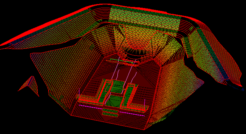
Before launching any construction project, obtaining an accurate 3D surface model is essential. Photogrammetry mapping plays a critical role in refining these models, aiding in layout decisions and guiding GPS machine control systems to ensure outcomes align with engineering specifications. This technique provides a foundation for success by delivering precise data that minimizes errors and accelerates project timelines.
Photogrammetry utilizes photographic analysis to determine surface point coordinates from multiple perspectives, with aerial photogrammetry offering significant advantages. By using drones to capture high-elevation images, this method enables comprehensive data collection across entire job sites with minimal restrictions. The resulting detailed models accurately replicate terrain contours, making photogrammetry indispensable for both pre-construction planning and active construction phases.
At Take-Off Professionals (TOPS), our team of engineering and surveying specialists excels in transforming photogrammetry data into high-quality 3D models. With extensive expertise and a wide range of precision photogrammetry services, we empower civil engineering and construction teams to achieve superior results with unmatched accuracy and efficiency.
Call us at 623-323-8441 to speak directly with a member of our team.
Request A Free Quote
Tailored Solutions for Every Industry
At TOPS, our photogrammetry services enable professionals across various industries to transform aerial imagery into accurate, high-resolution models and maps. By leveraging advanced drone-based imaging and post-processing techniques, we deliver actionable insights that streamline workflows, enhance visualization, and drive project success. Here’s how our photogrammetry services support different industries:

Aerial and Land Surveyors
We provide surveyors with precise aerial maps and 3D models created from drone imagery, improving the accuracy of topographic mapping, boundary assessments, and site documentation.
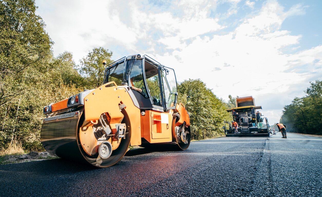
Roadwork and Highway
Our photogrammetry services produce accurate models and maps for road alignments, grading, and drainage planning, optimizing roadwork and highway projects.

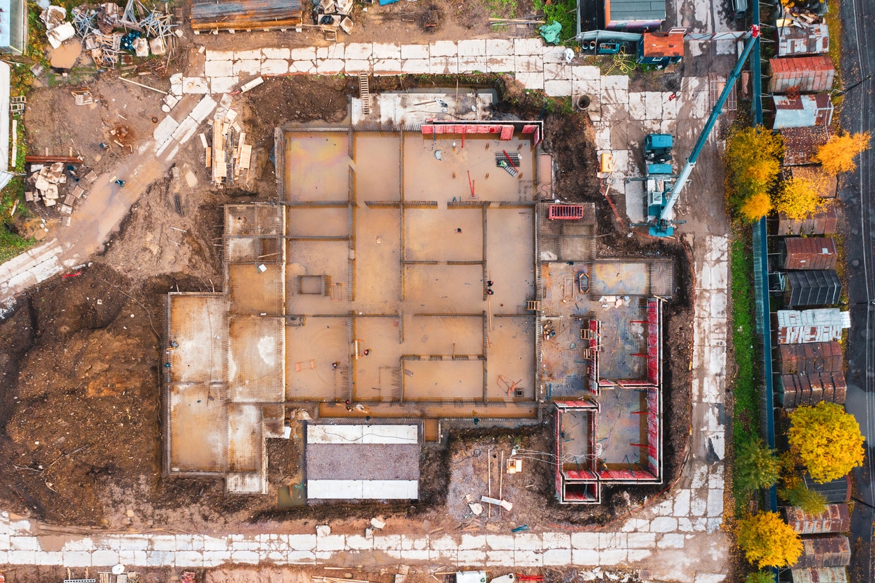
Civil Engineering
Our photogrammetry solutions generate detailed models and terrain data for infrastructure projects like bridges, grading, and drainage systems, enhancing planning and construction accuracy.
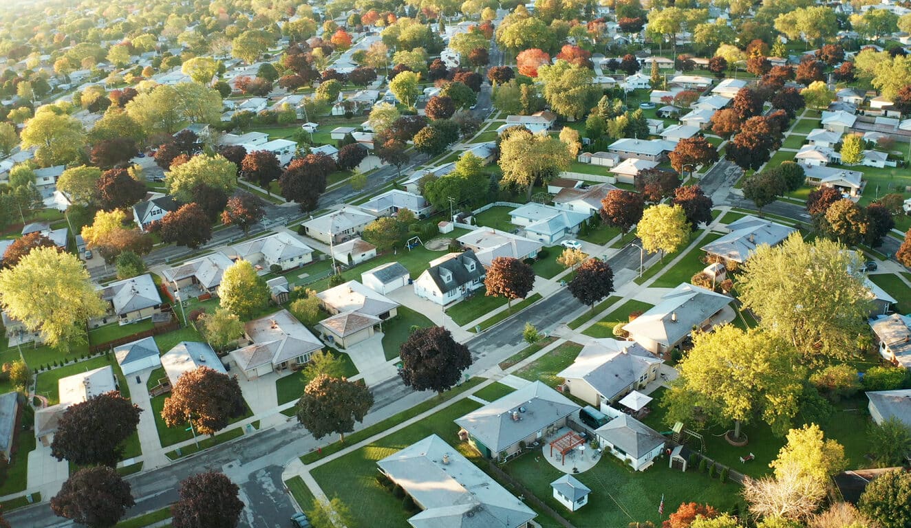
Residential Sites
We assist developers by creating 3D models and detailed maps for residential projects, supporting effective planning and design processes for homes and neighborhoods.

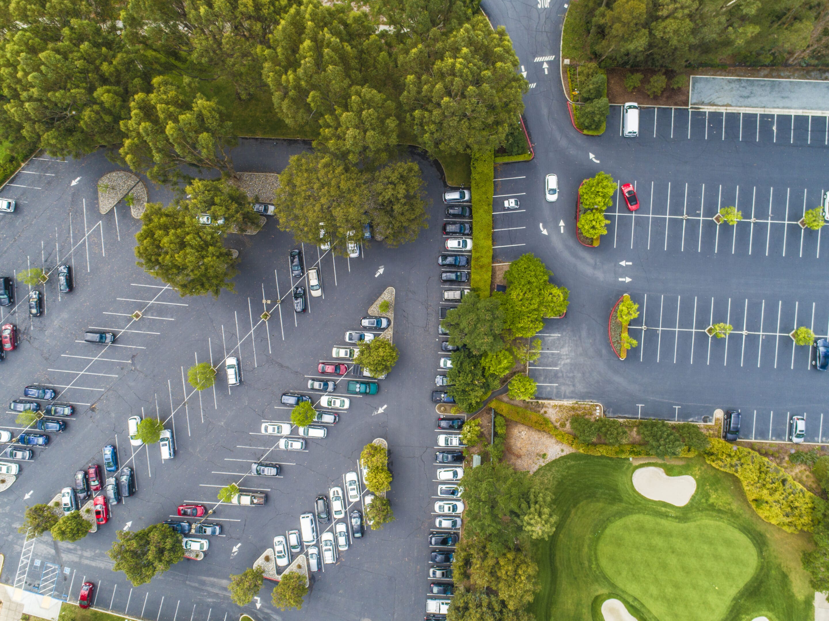
Commercial Sites
Photogrammetry helps us produce comprehensive site models and orthophotos for commercial developments, enabling better site planning and project visualization.
Urban Planning and Development
Photogrammetry provides urban planners with precise aerial imagery and models to design sustainable, functional urban spaces, including zoning and infrastructure layouts.

Landscape Architecture
We deliver high-resolution terrain and site models from drone imagery, allowing landscape architects to design functional and visually appealing outdoor spaces with precision.
Utilities and Pipelines
We use photogrammetry to create accurate models and maps for pipeline alignment, utility infrastructure, and maintenance planning, ensuring cost-effective project execution.
What our clients say
Photogrammetry Capabilities
TOPS prides itself on a dedication to construction data processing through high-quality photogrammetry services. We manage all forms of data with a strong emphasis on drone photogrammetry mapping. Our photogrammetry services translate aerial data into insightful information that tackles various project challenges.
Expert Photogrammetry Services: Mapping, Modeling, and Custom Solutions
Our extensive list of photogrammetry services covers:
- Precise mapping of drone data point surfaces using state-of-the-art photogrammetry mapping tools.
- Generation of highly accurate topographical files through advanced photogrammetry services.
- Customization of photogrammetry mapping solutions to cater to the unique demands of clients.
Utilize the comprehensive photogrammetry services and surface models we develop for critical tasks such as machine control, layout design, monitoring weekly production, managing billings, and addressing change orders. Beyond these applications, the timelapse imagery produced through our aerial photogrammetry mapping can serve as a powerful marketing tool once construction is completed.
Ready to discuss your project?
Converting Raw Data to Actionable 3D Models
People often ask what we need to get started on data prep for a project. The process is simple. We just need 3 things to get your data prep job started:
Step 1: PDF Plans
The first thing we need is the civil PDF plan set. This is the heart of the project and should contain all the information needed to build a detailed model or takeoff. Plans should show existing conditions, proposed layout, grading, and utilities, as well as demolition, erosion control, and more. Plans typically come in two formats: vector and raster. Vector PDFs are directly exported from the CAD files and have infinite scalability and sharp quality. Raster PDFs usually result from scanned pages and become pixelated or blurry when zoomed in. Vector plans are always preferred, but we can work with either.

Step 2: CAD Files
The next thing we need is the civil CAD drawings. CAD is compared to the PDF plans to ensure all project data matches and is up to date. We can work with almost any common file format, including the industry-standard AutoCAD .DXF and .DWG, as well as numerous proprietary formats like: PRO, TTM, TIN, DGN, GC3, TP3, TN3, and LN3. Some projects can be completed without CAD, but utilizing these files helps ensure the lowest possible cost and highest quality results.

Step 3: Project Details
Let us know how you want your project built. We can customize any job to your specific needs. You can follow the link on our website to fill out a data prep work order, or email us directly. Just provide the details for your scope of work. No matter what you want or need, we can build it!
We try to make the process as smooth as possible. If you need help or have any questions, just call, email, or click the link to contact us. We are here to help.
Why We Are The Right Partner
Photogrammetry is a useful tool for surface modeling of construction sites. If you’ve decided to use this technology, you need to ensure you’re getting the most out of your investment.
TOPS is a company exclusively dedicated to data. Our photogrammetry consultants can provide data point modeling quickly, so your team can get to work faster. Our full-time consultants have industry experience and software knowledge that allows them to produce models with high accuracy using data from many collection methods, including aerial photogrammetry.