A 3D model lets a civil contractor or construction professional perform machine control and layout planning before and during construction. Depth map sequencing and point cloud modeling are two examples of 3D modeling often used in construction. Although the two methods have some things in common, they ultimately have different goals and purposes. A point cloud is usually a collection of data points that form a shape, while a depth map conveys information about the distance between two objects in space.
Learn more about the differences and similarities between point cloud modeling and depth map sequencing below.
JUMP TO SECTION
Exploring Point Clouds in 3D Modeling
Point cloud modeling produces a set of small data points, which exist in three dimensions and on X, Y and Z coordinates. The data points represent a part of a surface in a defined area, such as the area of a construction site. When arranged together, the points produce a clearly identifiable structure.
The more data points in the point cloud, the more detailed the structure and image will be. You can compare the data points that make a point cloud to the pixels that make up a digital image. The more pixels there are in an image, the clearer the picture is.
Techniques for Generating Point Clouds from Depth Maps
Two methods can produce point cloud models — photogrammetry and Light Detection and Ranging (LiDAR), also known as remote sensing.
Photogrammetry
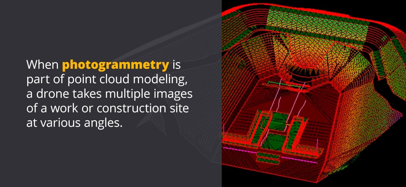
Photogrammetry is a relatively old process of collecting information about objects and surfaces. When photogrammetry is part of point cloud modeling, a drone takes multiple images of a work or construction site at various angles. After the drone takes the photos, the images are collected together and processed. Processing the images stitches them together, creating an overlapping picture and allowing you to build a 3D model from them.
While photogrammetry uses images to help you produce a 3D model, LiDAR uses laser beams. Typically, a device that transmits a laser is attached to an aerial vehicle. The vehicle goes up into the air, directing laser beams back to the Earth. The laser beams bounce off the Earth’s surface, returning to the vehicle.
Related Article: Photogrammetry: A Guide to Applications & Techniques
LiDAR
LiDAR measures how long it takes for the laser beams to travel from the surface back to the aerial vehicle. In some ways, it is similar to echolocation, except instead of using sound waves to measure distances, LiDAR uses light beams. The information collected by LiDAR can then be transformed into a 3D model. Once the images or information is collected, the process of transforming them into a 3D model is similar for both photogrammetry and LiDAR.
Often, LiDAR collects more useful information than photogrammetry, particularly if there is dense tree cover over the area being measured and modeled. A photo can’t push through branches and leaves to give an accurate measurement to the ground below. A light beam can travel through the spaces or openings in the tree cover, allowing you to see how far below the ground is.
One drawback of LiDAR is that it can be more sensitive to weather conditions than photogrammetry. It can also have difficulty collecting accurate information when the surface is reflective.
The two methods also vary drastically regarding price. If you are on a budget, one method of capturing information for point cloud modeling might be more appropriate for you than the other.
Related Article: LIDAR Surveying: A Guide for Precision 3D Models
Applications of Point Cloud Data in Various Industries
Point cloud modeling has several uses in construction and engineering projects. You might need to create a point cloud for the following:
- Surveying: Point cloud modeling can quickly and cost-effectively produce representations of roads, bridges and other complex structures.
- Earthworks projects: Earthworks projects, such as excavating to produce a new road or lay pipe, can also benefit from the use of drones or aerial vehicles and point cloud modeling. Point cloud modeling allows your company to keep tabs on a project without visiting the site in person. It can also help improve worker safety on-site.
- 3D models: Point cloud modeling also allows for the construction of more accurate 3D models for a project. The data captured during point cloud modeling allows you to accurately identify and distinguish objects in the area so you can create a precise representation.
Advantages of Using Point Clouds for 3D Representation
If you need to create a 3D model for an engineering or construction project, using point cloud modeling offers multiple benefits:
- Accuracy: A point cloud model is an accurate representation of an object or area. Both photogrammetry and LiDAR allow you to capture enough information to produce a detailed, correct model of a particular area.
- Ease of budgeting: Since the process of capturing information for point cloud modeling is so accurate, you can develop a budget for your project without too much concern about going over or spending more than you can afford. Point cloud modeling also minimizes the risk of mistakes, meaning you will spend less time and money on correcting errors. You will also save time on your project, which translates to cost savings.
- Efficiency: Point cloud modeling is a much more efficient process of building a 3D model, especially when compared to the time and effort it would take to create 3D models by hand. Increased efficiency means your project gets off the ground and can be completed sooner rather than later.
Understanding Depth Maps in Detail
A point cloud lets you see every data point used to create an image. A depth map gives you a view of the data points from a particular angle. Another way to look at a depth map is as a 2D image that has been manipulated to look like a 3D image. A depth map has information on the distance between objects in a picture. It’s often shown in grayscale.
After the creation of a depth map sequence, the grayscale image is usually merged with the initial photo. Combining the two creates a third picture that looks 3D.
Crafting Depth Maps: From Capture to Model
To create a depth map, you start with a 2D image. Since the goal is to turn a 2D image into a 3D one, the source image must have several layers. Ideally, the starting photo will have a background, middle ground and foreground. To produce the depth map, you’ll need a photo and an image-editing program, such as Photoshop.
Start by selecting areas of the foreground, using the magic wand or another selection tool to trace them. After tracing each section, create a layer. Once you’ve selected and created the layers for the foreground, select the part of the image that makes up the middle ground. After that, select the section of the photo that will be the background.
After selecting and creating the layers for your 3D image, grayscale each layer. The layers in the background should be a darker gray than the foreground layers, which should be the lightest gray. You might find it easier to work if you grayscale the image before you begin cutting out the layers.
Once you’ve produced the grayscale image, you’ll merge it with the original picture in the photo editing tool. The overlap of the two images produces a photo that looks 3D.
The Role of Depth Maps in 3D Visualization
One use of a depth map sequence is to create 3D advertising images. Another use is for producing 3D models for engineering and construction projects. Compared to a flat image, a depth map lets you see what is around or behind objects in a picture, providing you with a more accurate presentation of the area.
Depth Maps vs. Point Clouds: Delineating The Key Distinctions
The primary feature that point cloud modeling and depth map sequences share is both use images to transform data into 3D models. The two methods give you a way to view information.
One of the differences between depth maps and point cloud modeling is the image’s viewpoint. A point cloud lets you see every point. A depth map only gives you a view of the points visible from a particular angle.
Another way to look at the differences between a depth map and a point cloud is to consider the image’s dimensions. Cartesian coordinates include an X-axis and Y-axis, which intersect each other perpendicularly. X and Y axes are all that is needed for 2D images.
When an image is 3D, there’s also a Z-axis, which intersects the X and Y axes and runs vertically. X and Y are horizontal. With a point cloud, you can see the image from all three axes. In contrast, a depth map only gives you the information found on the Z-axis.
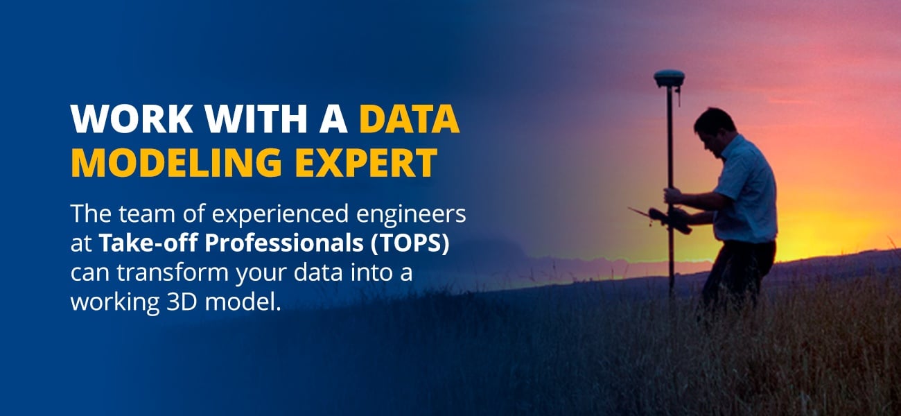
Expertise in Data Modeling: From Depth Map to 3D Model
Your project’s success depends on what you do with your data. The team of experienced engineers at Take-off Professionals (TOPS) can transform your data into a working 3D model. All you need to do is send us your plans and the CAD files and we’ll take care of creating the point cloud models. To learn more about our services and the benefits of working with data modeling experts, get in touch with us today.