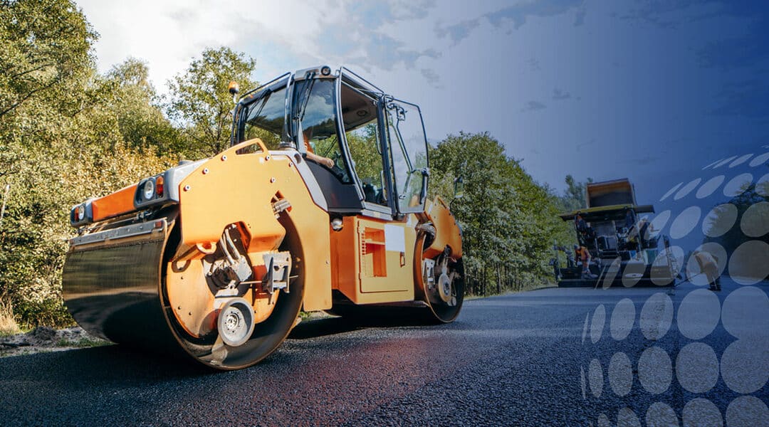
3D technology is a relatively new emerging tool with the potential to impact the roadwork construction industry significantly. Integrating 3D-engineered modeling into highway building and repair projects can help make them more efficient, benefiting construction workers and the general public alike.
Here we discuss what 3D technology is, how you can use it in roadwork projects and how it can ultimately benefit the industry as a whole.
How Is 3D Technology Used in Road Construction?
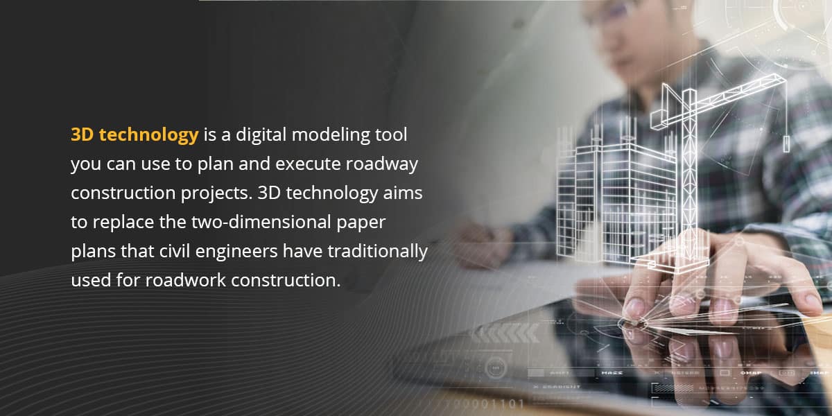
3D technology is a digital modeling tool construction teams can use to plan and execute roadway construction projects. Replacing traditional two-dimensional paper plans, 3D technology is a quicker, more cost-effective way to construct, maintain, survey and repair highways.
3D technology-rendered models are the result of comprehensive appraisal, design and coordination efforts. They produce a computerized depiction that accurately shows the existing site conditions and the designer’s intent. Contractors can use these 3D-engineered models to deliver a road construction project faster and with better accuracy than traditional 2D tools allow.
The process of creating a 3D model in construction begins with an aerial scan of the project site. Engineers use pilotless aircraft, such as drones, to survey the site. The aircraft transmits the data it collects to a scanning station, where designers use it to render a 3D representation of the construction site.
A complete 3D-engineered model includes the initial survey data along with suggested vertical and horizontal alignments, features and structures for the future site.
How 3D Technology Applies to Highway Construction
Whether contractors are building new roads or updating existing ones, 3D technology can help make the process safer, more precise and more efficient. Contractors can use 3D technology for automated machine control, project management and quality assurance.
For instance, 3D laser scanning allows construction workers to scan and record critical information about the road, using this data to develop an accurate plan. They can also prioritize problem areas to avoid potential issues during construction, thus speeding up overall project completion times and reducing traffic.
Additionally, 3D technology makes it easier to move and measure asphalt. Construction workers traditionally used milling machines for concrete removal. A 3D scanner helps them digitally detect the amount of asphalt they need to remove. Then, they can measure the precise amount of concrete they must pour to repair the road. Again, this can speed up the project completion time.
Read on to learn more about each of these innovative applications.
Automated Machine Control
GPS machine control negates the need for extensive staking and produces more accurate results. You can use it with the following roadwork construction equipment:
- Grading equipment: Machine-controlled grading equipment, such as dozers, motor graders and scrapers, provide data on the cutting edge’s position relative to the design surface, with no grade stakes needed.
- Excavators: Excavators outfitted with GPS or laser-controlled sensors can accurately measure slope, reach and elevation. The operator can visualize the elevation of the design and the tip of the excavator bucket.
- Compaction equipment: 3D technology-equipped compaction machinery like rollers lets the operator see live data on surface compaction directly beneath the roller as it moves. This intelligent compaction allows the roller to meet density requirements with fewer passes, cutting fuel and labor expenses.
- Milling and paving equipment: 3D technology controls the vertical alignment of a milling machine’s rotors. 3D milling equipment can use information from a data station to modify slope and elevation, eliminating extraneous work from placing and readjusting stakes.
Scheduling, Cost Estimating and Project Management
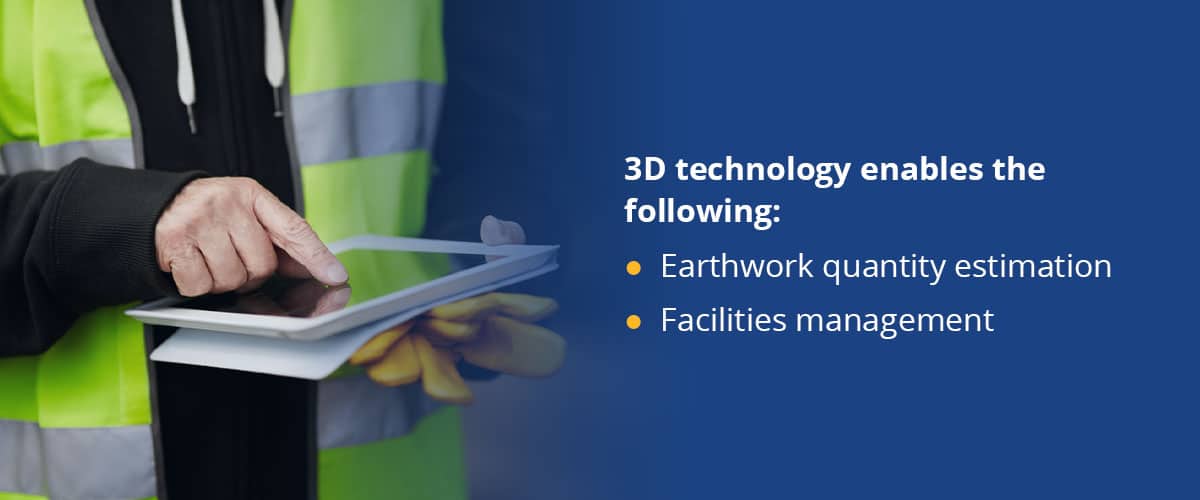
3D-engineered models can help civil contractors with cost estimating, scheduling and project management. In addition to streamlining the project for the contractor, these applications provide more value to the project owner. 3D technology enables the following:
- Earthwork quantity estimation: While earthwork quantity estimations are a crucial part of any project, they require significant amounts of time. It’s also often challenging to produce them with the high level of accuracy they require. 3D technology can render highly accurate quantity estimations in short periods. The computer effectively determines the cut-and-fill amount at small intervals throughout the model limits. The digital terrain model can also efficiently balance earthwork and propose haul routes.
- Facilities management: Civil integrated management involves the procurement, organization and accessibility of a highway facility’s precise information and data. This data includes planning, surveying, design, construction, maintenance, asset management and risk assessment. Civil integrated management syncs the designer’s 3D-engineered model with cost and schedule information to create a model that all project stakeholders can view.
Quality Assurance and Post-Construction
In addition to efficient scheduling and cost savings, 3D technology can also improve the quality assurance process during roadwork construction. With traditional 2D construction methods, inspectors must rely on grade stakes and 2D paper plans to ensure that grading operations follow the design. With 3D technology, inspectors can use handheld GPS devices to spot-check horizontal offsets and elevations.
The 3D-engineered model’s proposed grading surface lets inspectors perform random spot checks with GPS rovers to ensure the ground is graded correctly. The handheld GPS equipment compares the currently graded elevations to the proposed design surface at all locations within the 3D-engineered model’s limits.
Inspectors can also spot-check elevations behind the paver to confirm the paving machinery is set up and operating correctly. Contractors can rectify any discrepancies quickly, reducing the amount of rework needed.
Related Article: GPS Surveying Basics: Methods & Techniques for Accurate Data
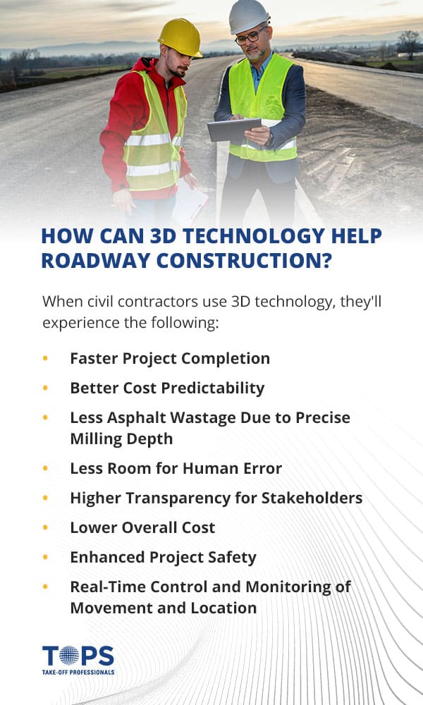
How Can 3D Technology Help Roadway Construction?
The applications above do more than simply modernize roadwork construction — they benefit it in multiple ways. When civil contractors use 3D technology, they’ll experience the following:
Faster Project Completion
With guidance from 3D-engineered model data, GPS-enabled machinery can operate all day and night and produce accurate grades on the first pass. In addition to decreasing waste and economizing resources, machine-controlled equipment’s first-pass accuracy helps contractors complete their jobs faster.
Better Cost Predictability
A 3D-engineered model lets clients and contractors see all project elements and how they interact, giving them access to the information they need to make decisions. Roadwork construction 3D technology allows engineers to quickly input the items they want to quantify and receive their numbers.
Integrating costs can help build an accurate budget and reduce cost overruns. Options like 5D models incorporate costs into the project. Contactors and clients can see when they’ll receive invoices for materials and when they’ll need to pay.
Less Asphalt Wastage Due to Precise Milling Depth
Using traditional milling equipment to remove asphalt is a wasteful approach. With machine control, operators can adjust the depth of asphalt they remove in real-time, producing less waste. 3D machine control helps the operator optimize the work and make it more precise. It speeds up the overall process and reduces the risk of making a mistake. As a result, the operator is less likely to have to start over, saving both time and money.
GPS machine control technology reduces milling depth in low points of a road, such as potholes, ruts or sunken culverts. At the same time, it increases milling depth at higher points of the road. It also avoids milling too deep, eliminating the risk of penetrating the asphalt to the granular.
Precise milling depth measurements enable pavers to enhance a road’s water drainage profile and produce a smoother surface. They also allow road crews to more accurately determine the exact material quantities they’ll need.
Less Room for Human Error
Few things are more frustrating in road construction than pouring concrete only to tear it back up later due to an error. While 2D construction plans work well enough to design highway systems, there can be disconnects between what’s on paper and what’s in the field. 2D plans usually include cross sections at every 50 or 100 feet, leaving the contractor to interpret the plans in between. This approach presents an opportunity for error. Misunderstandings can lead to inaccuracies, which ultimately result in a loss for everyone involved.
3D-engineered modeling lets contractors know exactly what to expect. With their unrivaled precision and accuracy, digital models significantly reduce errors. When you catch mistakes during the design phase, you can address them for a fraction of the cost of fixing them on-site.
With a 3D rendering, designers can immediately detect if something looks off. The software naturally provides clash detection by showing the entire project — if pipes intersect or contact a bridge footing, it’s immediately visible. 2D plans aren’t capable of displaying these conflicts, but a 3D model is essentially one large cross section, providing a whole new level of detail.
All the items in a 3D-engineered model are spatially related. The designer can view the model from various perspectives, such as elevation and isometric views, which helps them visualize the data. An engineer’s ability to identify design and constructability concerns before the proposal reaches the field decreases the chance of costly errors.
Higher Transparency for Stakeholders
3D-engineered models allow road construction contractors to walk through their projects before they pour an ounce of concrete.
Stakeholders can use virtual reality (VR) or augmented reality (AR) to view the project before getting underway. VR and AR improve communication and help with the integration of ideas. It also simplifies the process, giving stakeholders a clear idea of what they can expect from the project.
In addition to informing stakeholders, 3D technology can help give the public an idea of future developments. Giving the public more insight into these development plans opens the floor to their own input. You can use public feedback to find ways to better serve the community, integrating their ideas into the project.
Those outside of engineering and construction may find it challenging to visualize project elements by looking at drawings. Using 3D models in public meetings can help show laypeople precisely what the project will look like when it’s complete.
Lower Overall Cost
Though it has higher upfront costs, 3D technology can be worth the investment, as it helps civil contractors save money through the course of the project. This more than compensates for the initial design fee.
3D models can cost up to 10% more than the average design fee. While that’s a significant expense, you can save about 4% on the construction project overall. That means a 3D-engineered model for a $500-million project could save you $20 million.
3D modeling provides more precise results, warranting fewer changes and saving time and money. Automating tasks like subgrade, base course and pavement placement eliminates human oversight, reducing room for costly errors.
Enhanced Project Safety
3D technology automates tasks such as staking, stringing lines, drawing fill lines and setting grade stakes. Traffic is one of the main safety hazards for surveyors because it hinders their physical ability to measure the construction site while also putting them in danger of an automobile accident. Surveyors are often in the crosshairs of distracted drivers and other roadside hazards. Lane closures are an effective way of obtaining the data necessary to base map a project, but they require careful planning and significant expenses.
3D technology is a risk-free way to survey a project site. Mobile, aerial or terrestrial light detection and ranging are all surveying solutions that remove personnel from the hazardous roadside. Drones give construction project managers a detailed view of the site. Managers can survey difficult-to-reach areas without extra time delays or safety equipment. Drones are equipped with infrared cameras, radar and rangefinders to perform various inspection tasks.
Real-Time Control and Monitoring of Movement and Location
Intelligent technology like 3D models, on-site laser-based positioning systems and GPS machine control can help engineers control location changes and movement. Machine operators can also perform cuts, fills and grades with high precision automatically or with direction from an onboard system.

Experience the Future of Roadwork Construction With Take-Off Professionals
Take-Off Professionals is a team of knowledgeable and experienced engineers that uses 3D technology to build models for machine control, site work, and layout. We also provide fast and accurate construction material quantity takeoffs to help you estimate the cost of projects and win jobs.
Our full-time designers work in three different time zones to meet our clients’ needs. We work on jobs of all sizes, from custom home lots to full-scale highway projects, so you can count on us no matter what project you’re taking on.
Contact Take-Off Professionals today to learn more about how you can harness 3D technology in your roadwork construction projects.