As a civil engineer, you rely on various engineering computer programs to get the job done. The kinds of programs you’ll need depend on the kinds of projects you work on, as well as your specialization and where you are in your career. For example, new civil engineers might use mostly technical software, but more experienced engineers might use programs oriented towards project management. We created this list to highlight some of the most useful civil engineering software in the construction industry and beyond. So if you’re a seasoned engineer or studying to become one, these programs should be on your radar.
Maximizing Design Efficiency with AutoCAD for Civil Engineering
AutoCAD is one of the most widely used civil design software programs in the industry — and for a good reason. It’s a computer-aided design (CAD) software program that allows you to easily create and edit precise drawings. Some advantageous features of AutoCAD include:
These features make AutoCAD civil drafting an excellent choice for any engineer. You can easily attain the following benefits:
Versatility: Professionals across various industries use AutoCAD for project design, resulting in smooth collaboration between fields.
User-friendliness: The user interface is intuitive and straightforward, so anyone who has a foundational understanding of drafting can use the program.
Accessibility: AutoCAD is generally affordable. You can choose from a monthly, annual or three-year subscription, and they even offer a free yearly license to students and educators. Plus, training courses are widely available online.
Autodesk, the company that makes AutoCAD, also offers a more advanced civil engineering 3D software simply named Civil 3D. While AutoCAD is excellent for drafting, Civil 3D allows you to dive deeper into your project with various surfaces, alignments and profiles.
Leveraging Microsoft Excel for Civil Project Management
Microsoft Excel is probably the most widely used program in civil engineering. Engineers perform many functions in Excel, from project tracking to simple calculations.
Enhance Data Visualization and Calculation with Excel
Some other key features of Excel include:
Visualization: Using Excel, you can easily create charts, tables and graphs to visually display your data. This feature can be especially helpful for sharing data with stakeholders, architects and others involved in your project.
Calculation: Excel is good for repetitive calculations requiring only a few operations.
Flexibility: You can use Excel for various civil engineering applications, making it an incredibly versatile and cost-effective program.
Storage: You can store many different sets of data in separate spreadsheets. To better organize information, store different categories of data on new pages.
Templates: Excel templates make it easy to plug in relevant information without extensive formatting. This capability makes Excel an affordable application for project management as well as data entry.
Beyond Spreadsheets: Using Microsoft Access for Civil Engineering
Because it’s so ubiquitous, working knowledge of Excel is essential for success as a civil engineer. Fortunately, you can easily find affordable courses and training workshops online if you need to brush up on your skills. If you tend to create extensive spreadsheets, Microsoft Access can be a helpful alternative for Excel. Access is a database-building program included in the Microsoft 365 Suite for Windows. In addition to data storage, Access allows you to add forms to databases and export data to other Office applications, allowing seamless sharing and collaboration.
Project Tracking and Compliance with Primavera in Civil Construction
While Oracle’s Primavera P6 Enterprise Project Portfolio Management software is most useful for project managers, any engineering professional can use it. It’s a single-platform project management tool for keeping projects on track and ensuring compliance. Primavera P6 is a little more complicated than the other programs on this list, so it can help to take a training course or two before jumping in. However, its complexity allows it to handle projects of any size across many industries. Effective program use can increase your planning efficiency and prevent you from overrunning deadlines. Some helpful features include:
Standardization: This feature allows you to standardize business processes and best practices across all your active projects.
Multiuser system: Different teams across the organization can work simultaneously on the same project, and all their work is visible to the project manager.
Risk management capabilities: Proactively identify and resolve risks through the platform.
Real-time reporting: Get an accurate view of your project progress and assets as your team works.
Multi-device capabilities: You can bring Primavera onto your site using your tablet or smartphone.
While Primavera is one of the more costly options on this list, it’s a worthwhile investment for improving productivity on construction sites.
Streamlining Civil Engineering Workflows with Bluebeam Revu
Bluebeam Revu, more commonly known as Bluebeam, is a PDF editor similar to Adobe Acrobat. You can use it for many different workflows, including quality control, document planning and submittal. Bluebeam is handy when a CAD program might be too much of a hassle for one task. If you only need to view a design, or you need to make a few minor edits before submitting it for review, Bluebeam is going to be the program for you. Here are some key features:
Collaboration: Bluebeam’s Studio Sessions feature allows teams to view and edit a document at the same time, which can help you catch anything you may have missed in earlier stages.
Standardization: Bluebeam allows you to set up custom user profiles for different workflows, which is an excellent tool for setting markup standards. That way, you can streamline communication and accountability within your project teams.
CAD plugin: This feature allows you to easily export both 2D and 3D PDFs to send to stakeholders, which helps provide an accurate view of your project to the people you need to impress.
Multi-device capabilities: All you need to access your Bluebeam files in the field is your laptop or tablet, making your plans portable and easily accessible.
Partner with Take-Off Professionals for Expert Civil Engineering Data Preparation
Our extensive experience allows us to take on projects of all sizes, from parking lots to highways. In fact, we prepare more data in one week than some of the largest contractors will build in a year.
How Take-Off Professionals Can Enhance Your Civil Engineering Projects
Our engineers work across three different time zones to meet our clients’ needs. All we need from you is three essential pieces of information:
Your CAD files
Your paper plans
A completed work order
We’ll take those documents and use them to build your data exactly how you envision it. When you receive your data, it’ll be ready for use right away. Let us take some of the work off your hands. Contact us today for more information about how our data prep services can make your workplace more efficient. We can provide you with a detailed quote, including accurate turnaround times, so you’ll know exactly what to expect from us. We also offer free trials if you want to see what we can do for you.
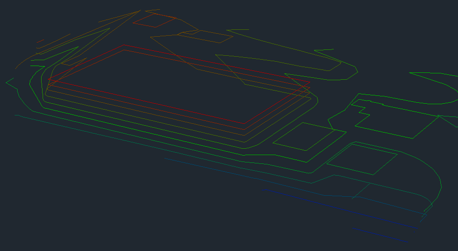
Topographic surveys allow you to map the terrain of a given landscape that you’ll be working on. These surveys incorporate everything from trees to existing buildings and utility poles. They can also map the various elevations on your job site. You can use topographic surveys to gain a better understanding of the landscape of your next project.
What Is a Topographic Map?
Topographic maps are visual models of all of the data collected during a survey. Your map will show all the elevations, natural and human-made constructions on your job site. Contour lines will denote the various elevation levels on your property, and there will be markers for everything else.
How Do You Use Topographic Surveys?
Topographic surveys help you determine the geography of the terrain. When you build new structures, you need to have an understanding of your landscape. You can use a topographic survey to determine the best locations for your new buildings or utilities. It will also tell if you need to perform any additional work like leveling.
Topographic surveys can also help you determine whether any areas on your property are off-limits due to elevational or other challenges. You can use a topographic survey to gather ideas about how the landscape will look once the construction is complete. Topographic surveys allow you to follow the necessary steps to reach the desired outcome.
What Instruments Are Used to Take Topographic Surveys?
Modern technology offers a few simple ways to create a topographic map, including:
Global positioning systems (GPS).
Electronic distance metering (EDM).
Trained professionals use these devices to take measurements and compare them to existing maps. The surveyor can then develop a topographic map demonstrating every detail about the terrain.
Topographic maps are useful in several different industries. Some of the most common jobs that require topographical surveys include:
Engineering.
Architecture and construction.
Government agencies.
Forestry.
Topographical surveys and maps are often used as the basis for a 3D blueprint for individuals in these sectors. A visual representation of the land features allows the workers to get a distinct sense of what they’re working with and how it might turn out.
Contact Take-off Professionals About Our 3D Model Services Today
At Take-off Professionals, we take the data collected from surveys and develop 3D topographical maps. Our team of full-time professionals is ready to help you visualize the data for your next project. Our primary focus is on optimizing data so you can use it effectively.
You can use our platform to access your data and upload additional files and notes. We’ve been working in this industry for over 20 years, making us experts in our field. Our teams work on around 1000 3D models each year.
We can offer you a detailed quote and fast turnaround times. We’re available on a national scale with technicians stationed in offices in three time zones.
Construction surveying is an integral part of the build process. Ensure that you’re completing the steps correctly to make your property safe and functional.
What Is Construction Surveying?
Construction surveying is staking out or determining reference points for the construction process. Construction surveying is about seeing what is already on the location. These items could be anything from patches of trees to existing buildings.
Construction surveying is also used to determine where the location of any new buildings should go. Keeping all of this information organized is vital to the construction process.
Why Is Construction Surveying Necessary?
When you start on new construction, you want to ensure that your plans will come out the way you intended. You need to know how to execute them to match your vision, keep your workers safe and follow any laws and guidelines. Construction surveys help you determine the safety of the land where you want to place a building, roadway or bridge.
Construction surveying allows you to better understand the area you have to work with. Ensuring the location is viable for the new build is vital to keeping workers, partners and clients safe during future use.
What Should Be Included in a Construction Survey?
You should include several elements in the construction survey process, including:
A basic border survey that marks where your property ends and another begins.
Some information on easements, other building locations, underground structures or utilities.
An outline of the elevations and contours of the land.
A plan of where new facilities and roads will go.
A reexamination of the finished project to see how closely it aligns with the measurements.
What Equipment Do Construction Surveyors Use?
Gathering all the information listed above requires specialized equipment. Some of the machines and tools construction surveyors use include:
Levels and theodolites: Surveyors use these instruments to measure angles, horizontal and vertical slopes.
Electronic distance measurement: Surveyors may also choose to use these computerized tools to take measurements.
Global positioning systems (GPS): Surveyors use GPS devices to measure and collect information about the land.
Geographic information systems (GIS): Surveyors can use these devices to create visual maps that represent all of the data they collect.
Contact Take-off Professionals About Construction Surveying Today
At Take-off Professionals, we understand the importance of accurate construction surveying on your next project. We are a team of full-time professionals who build 3D models for your construction jobs. Our only focus is to take your data and create something visual from it.
We have a platform that you can use to access your data and add other files and notes. Take-off Professionals has been in business for over 20 years, and we work on a national scale. We work on around 1000 3D models for machine controls every year. Our team provides detailed quotes and fast turnaround times, so you know exactly what you’re getting when you partner with us.
Contact us online today or call us at 623-323-8441 for more information about our services.
Finding volume with contour lines is essential to your business operations. Increase precision by calculating volume from topographical 3D models.
What Are Contour Lines?
You can find contour lines on topographical maps. These lines define the elevation levels of a particular terrain. Contour lines with a wider distance between them indicate a more gradual slope. If they’re close together, that means that the elevation is steeper.
Contour lines represent an area where all locations on that line are at the same height. We use these lines to determine the elevation and topography of a landscape. In the case of construction work, surveying the land can help you decide where to locate new structures and where you may need leveling work.
Ensure Material and Budget Accuracy with Our Help
At TOPS, our full-time professionals specialize in creating 3D topographical models using your data. These precision models, vital to any earthwork project, aid in optimal usage of materials and budget. Access our online platform for comprehensive oversight of your data and models.
You can determine volume using contour lines in two ways:
Prismodial method: This method offers a precise way to get an estimate of the volume. The formula is generally known as Volume = L(A + the square root of (A*B) + B) divided by 3.
Trapezoidal method: This method is also used in calculating volume with contour lines. The formula is Volume = L x 1/2 (A1 + A2) cubic meter.
Why Is Volume Calculation Important for Earthwork?
Measuring the volume of the land at your next project is vital for several reasons. First, if you want to create an accurate bid for the work, you need to know what type of landscape you’re working with. Using contour lines and topographical maps to determine volume will give you an idea of the work you’ll need to do. Then you can more accurately account for labor and material costs.
On that same note, calculating volume in an earthwork project also allows you to use your materials effectively. When you know the volume of the area, you can take the guesswork out of how much material you need for a particular project.
Contact Take-off Professionals for More Information Today
At Take-off Professionals, we use your data to create 3D topographical models. We optimize what you gather from a quantity survey to make models with contour lines to determine volume. Ensure material and budget use and accuracy with our help.
Our team is composed of full-time professionals who work on these projects as their specialty. We focus on creating dependable 3D models to use for determining the volume of the terrain for your earthwork.
You can access our online platform to view your data and models. You can even add other files or notes to keep all related materials in one place. Take-off Professionals has over 20 years of experience and works on around 1000 3D models yearly.
We offer detailed quotes that describe the exact services you’ll be getting. Our turnaround times are quick too, ensuring that you can get your work done on time. We have trained professionals on a national scale, meaning that we can help you no matter where you live. For more information about our 3D modeling services, please get in touch with us online or call 623-323-8441.
Incorporating GPS machine control into your earthmoving projects will help you in various ways. You can ensure you complete the work to the best of your ability by using machine control with 3D terrain models. Combine our services with your machines to make your business stand out for competency and dependability.
What Is GPS Machine Control?
GPS machine control involves the use of several instruments to give feedback to operators on grades and equipment positions. Some of the most common positioning sensors used to gather this information are:
Sonic tracers.
Rotating lasers.
Advanced GPS systems.
Total stations.
Creating a 3D model from predetermined positions gathered through GPS machine control increases accuracy. You can use equipment like dozers and excavators with the collected data to complete an action at exact coordinates.
Machine control technology works with the help of GPS and the Global Navigation Satellite System (GNSS). Earthmoving machines receive signals from these systems and compare them to the model of the proposed plans. This process allows the equipment to determine exactly where and how to grade the terrain.
You need a base station to ensure accuracy, however. Satellites are typically off in their measurements, making them unhelpful for precise work like earthmoving. The base station corrects these errors, allowing for a more accurate reading. A base station sends the reliable reading to a rover, developing a 3D map of the area and determining its location.
Who Uses GPS Machine Control?
Workers in any industry that deals with earthmoving equipment can benefit from GPS machine control. This technique is common in the following projects:
With GPS machine control, your team is more likely to do the job right the first time. Satellites that feed data to a machine take out all the standard work and make earthmoving jobs much easier than ever before.
Contact Take-off Professionals Today for 3D Modeling Services
Ensure your machines are working with an accurate 3D terrain model with the help of Take-off Professionals. Our team can optimize your data and make a map that works well for GPS machine control. You can access our platform to view the data and models and add any other files or notes.
At Take-off Professionals, we focus on creating reliable 3D data models that you can use for earthmoving work. With over 20 years of experience, we how to get the job done. Our team develops around 1000 3D models every year.
We’re proud to offer detailed quotes and quick turnaround times. Our staff is available nationally with employees stationed in multiple time zones. Reap the benefits of using GPS machine control for your earthmoving projects. For more information about our 3D modeling services, please contact us online or call 623-323-8441 today.
The construction industry has suffered from a prolonged period of decline in productivity over the last few decades despite the consistent growth of the industry. Low productivity is the leading reason for going over budget or spending too much time on construction projects. Thankfully, construction businesses can improve their productivity through improved communication, planning, goal setting and technology. Learn how to increase your construction productivity with the following tips.
1. Improve Communication
Clear and consistent communication is the most crucial component of getting your construction projects finished on time. Your team should always have open lines of communication and the ability to reach each other quickly. Improve communication with the following strategies:
Create a communication chain of command: Establishing a concrete chain of command for communication allows queries to get answered as quickly as possible and ensures nobody on your team gets left behind. Create a communication chain of command that sets clear expectations for who should be contacted for each unique project you work on.
Adopt new technology: By integrating smartphones, tablets and laptops into your team, you can ensure everyone receives the information they need right as it gets sent out. New software such as cloud-based programs and scheduling software can help you use your time more efficiently and effectively.
Enforce clear and concise communications: Messages heavy on jargon and technicality can be hard to understand and rarely pass up the chain of command, making enforcing clear and concise language in your communication essential. Teach your team members to keep language short, sweet and accessible.
Keep communications professional: When writing to your team, stick to the facts and keep your communications free of emotions and office politics. If you want to simplify processes and boost construction productivity, don’t over elaborate on your points and make your objectives clear.
2. Planning Based on Data
Inaccurate planning forecasts are a source of a significant source of risk for construction companies. Intensive data gathering using the power of deep learning and artificial intelligence can identify dangers and patterns for your construction plans before they even begin. The following data and analytics tools can help you increase productivity on the job site:
Predictive analytics: With predictive analytics, you can gain insight into project workflow and solutions to give your stakeholders more accurate expectations on when a project will be finished. Predictive data analytics allow you to reduce costs on projects and tackle potential problems before they get the chance to arise.
Risk analysis: Identifying, monitoring and responding to risks as they arise is critical to keeping your team safe and your time projections more accurate. You can use field-first technology to gain deeper insight into your risk management and analysis and keep your complex jobs going strong.
Equipment and asset tracking: By tracking your equipment and assets, you’ll eliminate the chance of wasting time on your construction site by ensuring the technology you need is where it should be 24/7. Certain asset tracking software even allows you to assign equipment to specific managers and teams.
GPS machine control modeling: GPS machine control modeling allows your surveyors to employ a variety of positioning sensors – including sonic tracers, rotating laser, total stations and advanced GPS survey systems – to improve work site operations. Many GPS machine control models integrate with machine control technology to ensure that equipment such as graders, bulldozers and excavators all move within the predetermined positions of the 3D model.
Having a realistic goal and planning for potential delays before they begin lets you stay ahead of schedule and ensure that your plans are achievable. It’s always best to set realistic expectations with your stakeholders rather than overpromise and underdeliver. Create more realistic goals with the following:
Build goals from the bottom up: Your employees on the ground of your construction site have a much better understanding of how long a project will take than your architect. Work with your managers at every level to build your goals from the bottom up and set accurate and realistic expectations.
Use both data and intuition: While data can start your project planning on the right foot, your intuition is crucial to creating realistic goals. Instinct is more than a hunch – it’s a culmination of your experience in the field.
Revise your goals as you go: Part of every successful plan is the acknowledgment that circumstances will change as you go. While you shouldn’t be too quick to revise your goals, you must review your construction goals continually and acknowledge precisely when and where you’re falling short. Make sure you review and revise your goals on at least a monthly and quarterly basis.
4. Have the Proper Technology
With the proper technology, you can ensure nothing falls through the cracks in your construction planning and execution. You can use the following tools to improve your productivity:
Preconstruction software: Preconstruction software enables your business to get your project started on the right foot by helping you with everything from finding contractors and sending bid invites to double-checking your architectural plans.
Field productivity software: With field productivity software, you can directly measure workflow on your job site and streamline information processes with cloud-based real-time software. Field productivity software helps you unify your team.
Project management software: Project management software ensures your teams are all working off of the same plans and getting updated about project developments along the way. When your team can get a holistic view of your project development, you’ll have the data and confidence to make better decisions.
Collaborative software: Collaborative software allows you to unify your team and keep up with construction plans and designs as they change in real-time.
Increase Your Productivity With the Take-off Professionals
At Take-off Professionals, we create data prep and 3D modeling software ideal for use with site work machine layouts and controls. Since our founding in 1988, we’ve been dedicated to supporting contractors with takeoff technology. Our innovative process helps you put quality data at your fingertips and gives you the accuracy and insight you need to be confident in your project. We offer the following services to help you boost productivity on the construction site:
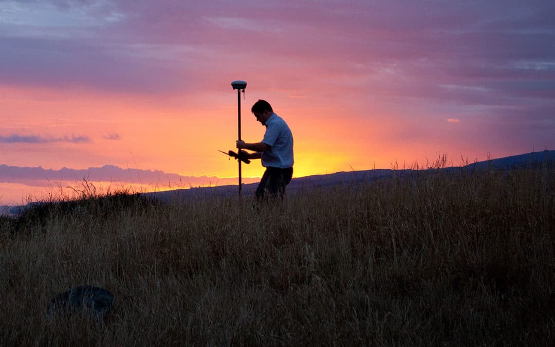
When civil engineers first plan to develop a property, they require land surveyors to provide accurate measurements and information about the land. As a result, land surveyors are critical to civil engineers who want to do their job properly. By working closely with land surveyors, civil engineers can increase their project’s safety, improve efficiency and ensure they comply with various standards.
Find out more about what land surveyors do and how these professionals assist civil engineering projects.
Exploring the Role of Land Surveyors in Civil Projects
Whenever an individual or company purchases a property to develop it, land surveyors play an essential role. Land surveyors are responsible for mapping and measuring a property’s land to establish property boundaries. They also provide information about the property’s topography and existing buildings or improvements. Surveyors can give clients precise measurements and data about a property, and they’re regularly employed for construction, engineering and mapmaking projects.
Given land surveyors’ expertise in determining topographic heights, land sizes and land measurements, they regularly advise the work of other professionals. For example, they often guide the work of geologists, developers, town planners, architects and engineers. You can even see them in governmental roles, helping sewer, power and water authorities receive the information they need to do their jobs well.
You’ll typically find land surveyors conducting measurements at the beginning of a development or construction project. They make their measurements, map the land and give this information to architects, who use it to design their projects with the landscape in mind. Land surveyors also provide their measurements to engineers, who use the data to ensure any planned structures are safe.
Boost Your Civil Engineering Project with Precision
Build on the strength of accurate data from land surveyors with TOPS. Our experienced team, driven by precision and dedication, creates 3D data to enhance site work, machine control, and layout, setting your earthworks project up for success.
The Synergy of Surveying and Civil Engineering Expertise
While public works, such as public education facilities or health care institutions, are some of the most common civil engineering projects, you can also find civil engineers helping organizations build bridges, pipelines and canals. Since civil engineering often requires structures and other infrastructure to be placed on top of the environment, land surveyors play an important role.
Infrastructure needs to be safe and fit the land it’s built on, so civil engineers need accurate land surveys before they begin their work. A land surveyor provides engineers the data they need to ensure their project doesn’t negatively affect protected environments. They also give engineers the measurements and information they require to ensure any structure they build will be safe. Land surveyors can even help engineers ensure their project has peak efficiency.
To support a civil engineering project, a surveyor will look for several land qualities. For example, they’ll often note the nature of the land, such as if it’s grassy, rocky, clear, forested, flat or uneven. They’ll also collect data about the angles and distance between critical points and measure relative elevations.
Information on natural features, such as rivers and hills, are other types of data included in land surveys for civil engineers. A land surveyor will also include data on human construction, such as power lines and roads. If a civil engineering project requires a map, land surveyors can produce it.
Once a project ends, civil engineers require an as-built survey from a land surveyor. This survey is meant to determine how accurate the initial survey’s data was after the project’s completion. The land surveyor will create a new survey designed to check that the earlier measurements match various details and positions of the final project. Civil engineers require surveyors to repeatedly survey a structure to ensure it’s safe and has the appropriate technical performance.
Critical Contributions of Land Surveying to Civil Engineering
One of the biggest reasons civil engineering projects need land surveyors is that they provide accurate data engineers can use in their proposals. Land surveyors are also important because they can conduct inspections in high-risk areas and help resolve legal disputes. Learn more about the importance of land surveyors and some of the essential ways they aid civil engineering projects:
Enabling Precise Proposals with Detailed Survey Data
As civil engineering organizations create proposals, they need accurate data. When a civil engineering organization submits its proposal, it often needs to gain public support — whether through lawmakers voting on the project or the public directly voting for it. If a project appears dangerous, it can sink, leading the public or lawmakers to vote against it.
Accurate data helps engineers create a proposal that shows the infrastructure will be as safe as possible. For example, a land surveyor might use a 3D simulation via drone survey to show how a structure will impact the environment. If the survey reveals a new road could lead to erosion in the surrounding area or impact water flow, civil engineers can adjust their proposal to account for these potential dangers.
With accurate data in their corner, engineers can prepare more detailed proposals. These detailed proposals help lawmakers who want the project to pass, as they can more easily showcase how safe the project will be in the future and how it will change the current environment. Since safety is a huge public concern, civil engineering firms may find it difficult to get public lawmakers on board with a project until they prove it doesn’t come with high risk.
Performing Specialized Inspections in High-Risk Zones
When civil engineers need to work on high-risk projects, such as bridges, they often turn to land surveyors. Surveyors usually have the equipment required to safely assess a project site without putting staff in danger. For example, a land surveyor can use a drone to assess high-risk areas that people can’t easily or safely access. Using a drone is much safer and can deliver more detailed results, as it can navigate around complex terrain or structures and gain a bird’s-eye view of a property.
Since civil engineers play a major role in creating or repairing high-risk projects, such as dams, canals and bridges, they need highly accurate data to ensure they don’t put the public in danger. If a dam breaks or a bridge crumbles, it can lead to injury and death. A land surveyor can conduct a survey before and after a project to ensure civil engineers have the necessary data to build safe structures.
Clarifying Property Legalities: The Surveyor’s Role in Dispute Resolution
Sometimes, civil engineering projects face disputes over private and public property. A private landowner may believe the project crosses over to their property, while the civil engineering firm may believe their project only goes over public land. When there’s a dispute about property lines, land surveyors can help to resolve it. Usually, a land surveyor will conduct a boundary survey to establish whose land the civil engineering company is developing their project on.
A land surveyor will often use a drone to conduct these boundary surveys, as they can establish property lines faster. With a bird’s-eye view of the property lines and the use of other surveying technology, they can quickly find where private land stops and public land starts. A land surveyor may also use LiDAR scanning and UAV technology to ensure their surveys are as accurate as possible.
By using advanced technology to complete their boundary survey, a land surveyor can quickly resolve legal problems and stop delays from occurring. These surveys can also increase public support in the project, as people will know the civil engineering project is only using public land.
Identifying the Right Time to Engage a Land Surveyor
When you plan to develop a piece of land, you’ll need a land surveyor. Since you’ll need to comply with your project’s end goal, building goals and local regulations, a land survey is an essential part of development. With a land survey, you’ll gain a better understanding of the site’s topography and dimensions, giving you critical data to ensure your project doesn’t run into compliance issues.
One of the most important times to use a land surveyor is when you’re planning to change the land’s use. In this case, you might need a planning permit. Part of attaining this permit involves receiving approval from a local government, where they’ll check overlays, land zoning, municipal strategic statements and permitted land uses. A land survey is often required to ensure your project meets the aforementioned permit requirements.
Land surveys are also necessary when a project has different zoning requirements on a site. For example, a piece of land may have various overlays on it, such as protections for vegetation, wildlife or heritage. You might find that land has different local provisions, such as plot ratios and building heights. With these various zoning and land requirements, land surveys are essential. These surveys give you data about topographic heights and land that is critical for addressing zoning requirements.
Another time you’ll need a land surveyor is when you’re working on a sloped site. Since a land surveyor can use specialized equipment to measure horizontal distance, they can assist civil engineers who might not have equipment capable of making these measurements. You can also rely on surveyors to measure vertical distance. These measurements are critical when your project requires you to excavate a pipeline or build a drain or road.
Essentially, any time you need to know exactly how a project will fit on a piece of land, a land survey is needed. Whether you’re constructing a new bridge or upgrading a road, land surveys allow you to know how your planned structures will fit with the land and ensure your project won’t cause safety issues.
Partner with Take-off Professionals for Advanced 3D Surveying Solutions
Many civil engineering firms and organizations rely on the benefits of land surveyors to improve their projects with the following:
Increased boundary accuracy: One of the many land surveying benefits is helping civil engineers establish accurate boundaries for a piece of land. With the right property boundaries established, a civil engineering team can better plan out construction and development. Accurate boundaries also help teams avoid legal disputes with people who own land near their project, saving time and raising public satisfaction with a project.
Greater understanding of topography: Before civil engineers begin a project on a piece of property, they need to know its topographical details. A land survey ensures engineers have a better understanding of topography, such as determining if the land has any structural or soil issues or if it is prone to flooding. By gaining a greater understanding of a plot’s topography, the civil engineering team can determine if their project is feasible and safe before they begin development.
Better property division: When a civil engineering firm makes their proposals to local authorities, they need to ensure they’re not building on private property. A land survey gives them better property division by clearly showing where public property starts and ends.
Improved construction preparation: Before a civil engineer OKs construction, a land survey can give them various data about the plot. This land survey’s data can help civil engineers ensure any structures are placed in the ideal location and that any necessary preparation has been completed prior to construction. With this data, a civil engineer can provide their construction team more accurate plans and help them better prepare for construction.
More accurate value estimation: Land surveyors can also help civil engineers and other professionals determine how much a piece of property is worth. By having a detailed land survey, you can more accurately value a property based on its landscape, hardscape and location details.
Choose Take-off Professionals for Your 3D Data Needs
At Take-off Professionals, we understand the need for accurate data from land surveyors for the success of any civil engineering project. After receiving data from surveyors, our experienced engineering team creates 3D data to assist with site work, machine control and layout. Alongside our engineers, we also employ surveyors and 3D techs to ensure any models we provide are extremely accurate and give you the information you require to ensure a project is safe and can be completed as efficiently as possible.