Over the past 15 years we have had to sort through different types of 3D data for a job. In this presentation, I will go over some issues we find when dealing specifically with roadway rehabilitation. Issues can come up with any type of construction data. However, roadways are more critical. Maintaining traffic and smoothness requires higher precision than a new parking lot for a retail site.
The major interstates are in place, but in different areas they are getting widened and constantly repaired. Larger arterial roads get re-routed and widened as population changes occur. These and other factors mean that you need to be efficient at this type of work as there is a lot of it out there.
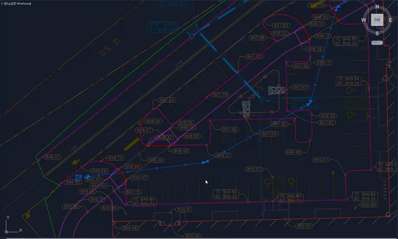
In our hypothetical case, we are milling, filling, and widening a road section. Here are the various types of data you could receive for existing conditions on a job.
GPS Rover Shots
The project has been worked on for a while and uses GPS to get things organized. The job is calibrated, and work has been done in the field. Some topo shots have been taken of the edge of pavement, so the new lanes have a vertical to attach to. The main issue here is the quality of the data.
- How good is the calibration?
- Did the operator check the known control?
- How long was the point occupied? In heavy highway work, long observations are dangerous.
- Was the pole plumb?
- How recently was the rover pole calibrated?
There is no way to know this information by reviewing the metadata of a shot or a session. No assumptions can be made regarding quality. Hopefully, there is an opportunity to make a surface of the data to check accuracy. Yes, there can be issues with the GPS performing the check. Where precision is an issue, I do not fully support GPS only information.
GPS survey information gets used a lot, and we work with it all the time. No need to stop trusting GPS rover data. You do need to be aware of the problems you may encounter when counting on it for high precision. Fully trusting GPS data for a highway reconstruction will most likely not get a rideability bonus.
Related Article: GPS Surveying Basics: Methods & Techniques for Accurate Data
Drone Topo
I have been doing topo work with drones since the infancy of using drones to collect data. Drones are a great tool but must be used properly. In addition, expectations must be managed to provide accurate information within tolerance.
The best accuracy one should expect from a drone topo is half a tenth (.05’). That is great news for doing interim dirt topo(s) and pre-job topo(s) on mostly cleared land. Photogrammetry software does not perform well with a single-color surface. We often have problems with sand and dirt work that is smooth and monotone. White and asphalt paving both have the same issue. It is difficult to get any consistency with photogrammetry modeling on these surfaces. Things get worse when you try and extract curb data, and elevations jump. Photogrammetry techniques cannot be used to obtain paving elevations for rehabilitation and widening.
Over the years we have provided drone topo(s) on heavy highway projects. That information is used as part of a hybrid surface. The drone is great for slopes and medians while a higher accuracy method is employed for paving areas.
Drone LIDAR
I am excited about the use of drones for LIDAR (Light Detection and Ranging, 3D Laser Scanning). We have relied on full scale aircraft mounted LIDAR for years and are happy with the results. The problem with drones and LIDAR is vibration. The measurement is taken and by the time the unit gets a return, the vibration has put the unit in a different location. Yes, the change is small but enough to cause inaccuracies that are being improved upon every day. I have visited some white papers on new offerings and am confident the issue will be sorted soon. I feel within a year, the process will be accurate and repeatable. Within five years of that prices will drop so this will become the norm.
Mobile LIDAR
Many of us have seen mobile LIDAR units at tradeshows. The late model SUV with a GPS antenna and a big scanner mounted on top is impressive and expensive. I get a lot of calls and emails on this topic, and the manufacturers know this needs to be solved.
Mobile LIDAR is a great solution, but the issue is in the cost. Figures can vary based on options and software but $750,000.00 is a good estimate all in. That’s too much money for a contractor, so leaving it to survey and mapping companies is a better option. I have consulted with numerous firms considering the purchase of this equipment. Here are the facts.
- It is expensive.
- There is a steep learning curve.
- People will need to be hired to operate and maintain the gear and vehicle. Usually two expensive office/field operators.
- To gather and process the huge amounts of data collected, you will need:
- Expensive field laptops
- A lot of solid state portable hard drives. This data is easier to express mail than upload in many cases.
- An office computer(s) to do initial processing and reduction to specified densities. This takes a long time and can use up to three powerful desktop units to keep various jobs on schedule.
- Finding people to buy data. This unit needs to be moving all the time. The crew will be on the road a lot. Depending on population density, a 500-mile radius may be needed to make this profitable.
As you can see, quality data comes at a cost. When hiring the service to be done for you, expect from 4-10 thousand dollars a mile depending on the job and distance from the unit’s home base as well as the project size.
Ground Based LIDAR
Currently, the use of this technology is striking the balance between accuracy and cost, and it comes with a price. Ground based LIDAR can be as accurate as necessary for paving work. As with any technology, especially one we are expecting high precision, conditions need to be met.
- The job needs to be localized and the quality of that must be verified. LIDAR needs to be setup over known points. This is not necessary for all scans, as they will register to each other. On any linear project like a roadway, there needs to be a high number of good control points for verification and setup.
- Operator error is the main issue we see for poor data. It is easy to use but setup and operation are procedural. If one step is missed in the process the data quality will suffer.
- These instruments are sensitive and need to be handled carefully. If a drop or a fall happens and the unit is not checked, data quality can suffer.
- Training is not too difficult. One person can do the work and needs to be responsible for the unit.
- Prices are dropping to the point where a contractor can pay for a unit with the profit from a job or two. Rental is an option as the dealers know you need it and may not want to purchase.
- File sizes are going to be big, so be prepared for a lot of storage space.
- Scan only what is needed. We see a lot of scans including trees. We are doing roads, not lumber.